Oregon Dry Thunderstorms: Causes And Impacts
viral.buzzorbitnews
Aug 04, 2025 · 6 min read
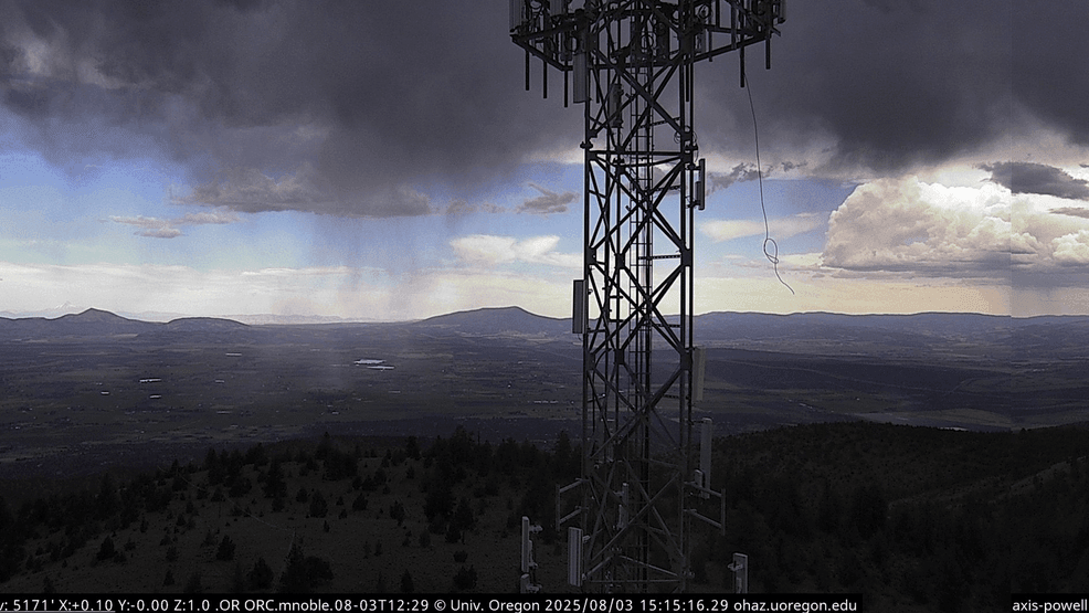
Table of Contents
Oregon Dry Thunderstorms: Causes and Impacts
Oregon, known for its lush forests and abundant rainfall, might seem an unlikely place for dry thunderstorms. However, these powerful and dangerous meteorological events do occur, particularly in the eastern part of the state. Understanding the causes and impacts of these dry thunderstorms is crucial for public safety, resource management, and mitigating the increasing risks associated with climate change. This article will delve into the meteorological processes that generate Oregon's dry thunderstorms, exploring their unique characteristics, the hazards they pose, and the potential consequences for the environment and human populations. We'll also examine how climate change might influence the frequency and intensity of these events in the future.
Understanding Dry Thunderstorms
Dry thunderstorms, also known as "heat thunderstorms" or "convective storms," are characterized by the absence of significant precipitation reaching the ground. This doesn't mean they lack intensity; instead, the precipitation evaporates before reaching the surface, a process known as virga. This evaporation is driven by the extremely dry air present in the lower atmosphere, a common feature of the high desert regions of eastern Oregon. While lacking the rain, these storms still pack a powerful punch, bringing the dangers of lightning, strong winds, and even sporadic, intense bursts of hail.
The Meteorological Dance: Causes of Oregon Dry Thunderstorms
The formation of Oregon dry thunderstorms is a complex interplay of atmospheric conditions:
-
Instability: A crucial element is atmospheric instability, where a layer of warm, less dense air sits atop a layer of cooler, denser air. This unstable arrangement creates a potential for upward movement, initiating the development of cumulonimbus clouds – the birthplace of thunderstorms. In eastern Oregon, intense daytime solar heating of the ground readily generates this instability.
-
Lifting Mechanism: The unstable air needs a trigger to start rising. This "lifting mechanism" can be several factors, including:
- Orographic Lifting: As air masses encounter mountain ranges like the Blue Mountains or the Cascades, they are forced to rise, cooling and potentially leading to cloud formation and thunderstorm development. This is a frequent trigger for thunderstorms in Oregon.
- Convergence: Where air flows converge, it is forced upwards, leading to rising motion and thunderstorm initiation. This often occurs along boundaries between different air masses.
- Daytime Heating: The sun's intense heating of the ground in the eastern Oregon high desert creates thermals (rising columns of warm air), directly fueling thunderstorm formation.
-
Dry Air: The hallmark of a dry thunderstorm is the presence of extremely dry air in the lower atmosphere. This dry air efficiently evaporates any precipitation falling from the cloud, preventing it from reaching the ground. The presence of a significant amount of moisture aloft, however, is still necessary for cloud development and the generation of lightning. The contrast between the dry lower layers and the moist upper layers is a key ingredient in the formation of these storms.
-
Wind Shear: The variation of wind speed and direction with height (wind shear) plays a crucial role. Strong wind shear can influence the shape and longevity of the storm, potentially leading to more intense and longer-lasting thunderstorms. It also affects the orientation and intensity of the downdrafts, which can exacerbate the wildfire risk associated with dry thunderstorms.
The Impacts: A Cascade of Consequences
The absence of rain in dry thunderstorms doesn't diminish their impact. Instead, they bring a unique set of hazards:
-
Wildfires: This is perhaps the most significant and devastating impact of Oregon dry thunderstorms. The intense lightning strikes ignite dry vegetation, easily starting wildfires in the already arid landscapes of eastern Oregon. The lack of rain means that these fires can rapidly spread, becoming difficult to control and causing extensive damage. The dry air also fuels the intensity of the fire, making them particularly dangerous.
-
Lightning Strikes: Dry thunderstorms can produce frequent and intense lightning activity. These strikes pose a significant threat to both human life and property, as they can ignite fires, damage power lines, and cause injuries or fatalities. Livestock are also highly vulnerable.
-
Strong Winds: Downdrafts from dry thunderstorms can produce damaging gusts of wind, posing a threat to structures and infrastructure. These strong, dry winds can also quickly spread already ignited wildfires.
-
Hail: While less frequent than in wetter thunderstorms, dry thunderstorms can still produce hail, although it often evaporates before reaching the ground (graupel). This could still cause damage to crops and property.
A Scientific Perspective: The Role of Atmospheric Dynamics
The formation of dry thunderstorms involves complex atmospheric dynamics governed by the principles of thermodynamics and fluid mechanics. The release of latent heat as water vapor condenses within the rising air parcels is a crucial driver of the storm's intensity. This process fuels the upward motion, generating the towering cumulonimbus clouds characteristic of thunderstorms. However, the presence of a deep layer of dry air below the cloud inhibits precipitation reaching the ground, leading to the characteristic virga. The interaction between the dry air and the moist updraft also influences the stability of the storm and its potential for generating strong downdrafts and associated hazards. Modern numerical weather prediction models are increasingly sophisticated in forecasting these complex interactions, leading to improved warnings and predictions of dry thunderstorms.
Frequently Asked Questions (FAQs)
-
Q: Are dry thunderstorms common in Oregon? A: While not as frequent as wet thunderstorms, dry thunderstorms are a recurring phenomenon, particularly in the eastern part of the state, especially during the summer months when conditions are dry and hot.
-
Q: How are dry thunderstorms different from regular thunderstorms? A: The key difference lies in the precipitation. Dry thunderstorms produce little to no rain reaching the ground because of the dry air mass below the storm. While visually similar, they lack the beneficial rain and instead carry heightened wildfire risks.
-
Q: How can I stay safe during a dry thunderstorm? A: Seek shelter indoors, away from windows and doors. Unplug electronic devices. If caught outdoors, find a low-lying area, avoid tall objects, and be aware of the potential for lightning strikes. Be aware of wildfire risks.
-
Q: What role does climate change play? A: Climate change is likely to exacerbate the conditions favorable to dry thunderstorms. Increased temperatures and altered precipitation patterns may lead to more frequent and intense dry thunderstorms, exacerbating wildfire risks.
-
Q: How are dry thunderstorms predicted? A: Meteorologists use advanced weather models and satellite imagery to monitor atmospheric conditions. Looking at factors like instability, wind shear, and moisture content allows them to predict the likelihood of dry thunderstorm development.
Conclusion and Call to Action
Oregon dry thunderstorms represent a unique and significant meteorological hazard, posing substantial risks to the environment and human populations. Understanding their causes, impacts, and the role of climate change is crucial for developing effective mitigation strategies and improving public safety. The information presented in this article highlights the complexities involved and underscores the need for continued research and improved forecasting capabilities. For further insights into Oregon's weather patterns and wildfire preparedness, explore our other articles on wildfire prevention and weather forecasting technologies. Stay informed, stay safe.
Latest Posts
Latest Posts
-
Understanding The 4 2 3 1 Formation
Aug 04, 2025
-
What Are The Potential Weaknesses Of This Formation The Formation Can Be Vulnerable To Counter Attacks If The Midfield Is Overrun Defensive Solidity Relies Heavily On The Midfielders Ability To Win Back Possession
Aug 04, 2025
-
Violent Thunderstorms Are Fueled By Atmospheric Instability Warm Moist Air Rises Rapidly Colliding With Cooler Air This Creates Powerful Updrafts And Downdrafts Leading To The Formation Of Severe Weather Phenomena Like Hail And Strong Winds The Instability Is Often Exacerbated By Specific Weather Patterns And Geographical Factors
Aug 04, 2025
-
Safety Measures Stay Informed Through Official Weather Channels Avoid Unnecessary Travel Secure Loose Objects Around Your Property Have A Plan In Case Of Power Outages Know Your Emergency Contact Numbers
Aug 04, 2025
-
Stay Safe Stay Informed
Aug 04, 2025
Related Post
Thank you for visiting our website which covers about Oregon Dry Thunderstorms: Causes And Impacts . We hope the information provided has been useful to you. Feel free to contact us if you have any questions or need further assistance. See you next time and don't miss to bookmark.